About ClimateBC
ClimateBC is a free MS
Windows software package that generates scale-free climate data for specific locations and for gridded climate data at any spatial resolution. It is developed and maintained by the
Centre of Forest Genetic Conservation, Faculty
of Forestry, the University of British Columbia (UBC)
and sponsored by the BC Ministry of Forests.
All data generated using ClimateBC are subject to the CC-BY license.
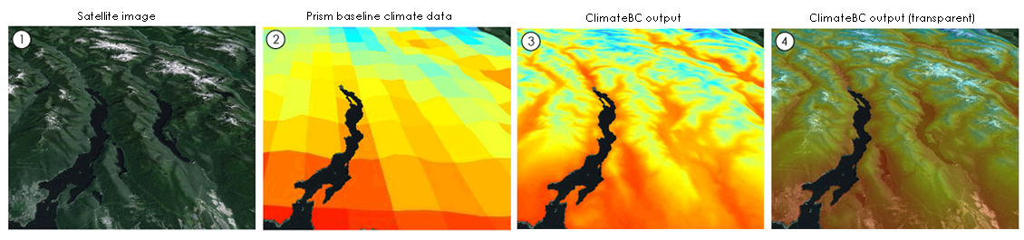
ClimateBC is a standalone MS Windows application that downscales PRISM (Daly et al. 2008) 1971-2000 gridded monthly climate
normal data (800 x 800 m) to scale-free point locations. It calculates and derives many (>200) monthly, seasonal and annual climate variables. ClimateBC also uses
the scale-free data as a baseline to downscale historical and future climate variables for individual years and periods between 1901 and 2100. The coverage of
ClimateBC is shown below. All data generated using ClimateBC are subject to the CC-BY license. To download the package, please click here. For scale-free climate data beyond this coverage in North America, please visit ClimateNA.

Main features
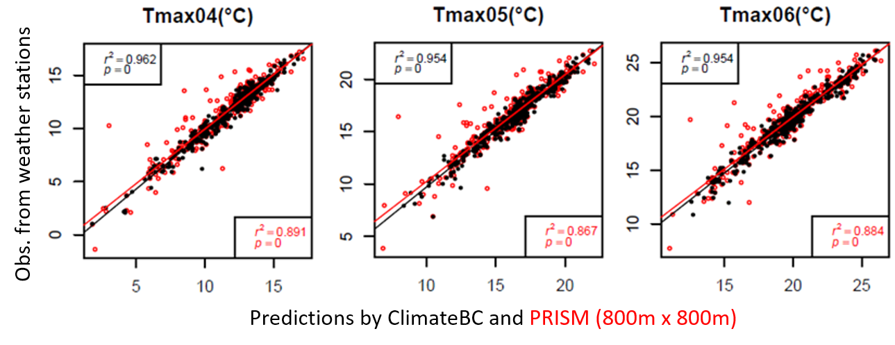
1. Scale-free climate data
ClimateBC generates scale-free climate data that facilitates users to obtain climate data for specific locations (instead of grid averages) and climate surfaces at
any spatial resolutions.
The scale-free climate data considerably outperform the PRISM data as shown in the following graphs. Please read the report and a recent publication for details.
2. All-in-one package
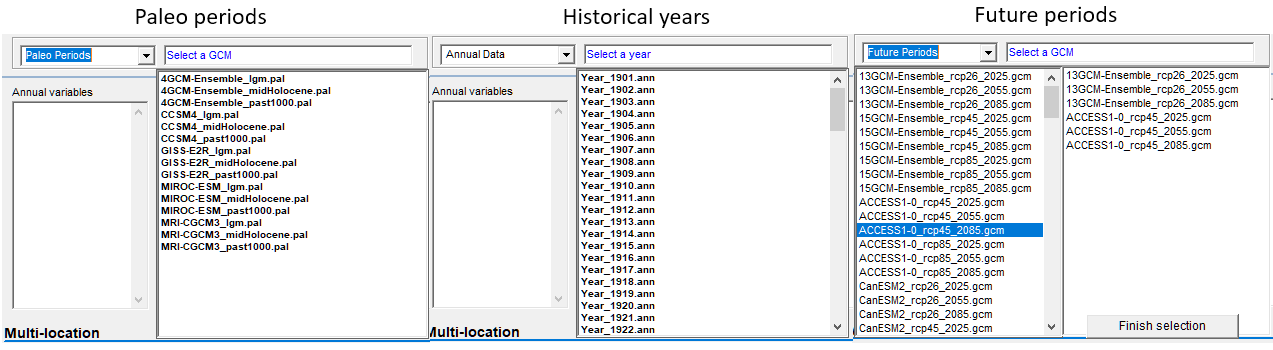
ClimateBC integrates and downscales climate data for Paleo, historical and Future years and periods.
3. Multiple-location and miltiple-GCM processing
ClimateBC can process almost unlimited number of locations in a single run (Youtube video). it can also generate climate data for multiple GCMs in a single run (Youtube video).
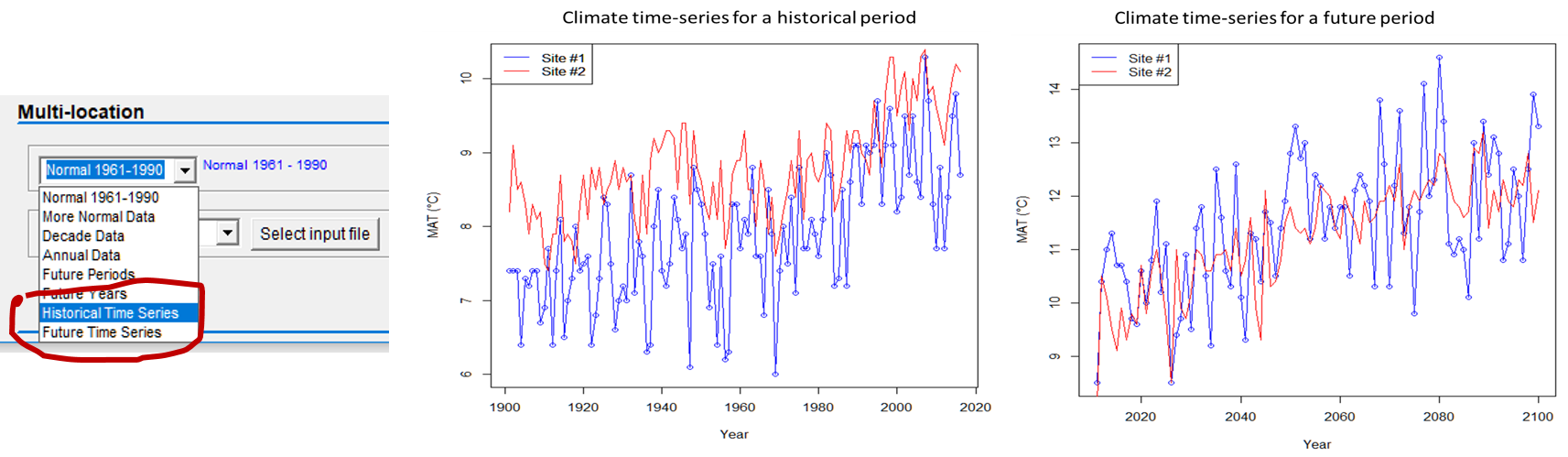
4. Time-series functions
ClimateBC can generate time-series climate data for historical (1901-2018) or future years (2011-2100) for multiple locations in a single run. A Youtube video is available to show how.
5. Map-in and map-out capacity
Since version 6.0, ClimateBC can read DEM raster file and generate climate variables in raster format for mapping. A tutorial video is available on Youtube.

6. Command-line operations support
· The proegram (since v7.20) supports command-line operations and can be called in other programs, such R or Python. Thus, it can be integrated into your programming workflow.
7. Map-based version for easy access and spatial visualization
ClimateBC version allows users to: 1) get climate data for a location by clicking on the map; 2) visualize the spatial distribution of main climate variables; 3) visualize BEC zones and their shift in future climates; and 4) Visualize forest tree species distributions. Please click on the map to access the web version.

8
. Web API version
ClimateBC/NA web API version allows users to: 1) get climate data through a browser using an URL; 2) incorporate climate data into your own web or mobile applicaitons;
and 3) integrate climate data into a development environment, like R or Python. Please click here to download the instructions.
9
. ClimateBC/NA R package
The ClimateBC/NA R package ClimateNAr allows users to: 1) download spatial climate data for specific climate variables; 2) making raster stacks for spatial predictions; 3) inquire climate variables through web API and desktop API (CMD Line access); and 4) scan for top important climate variables for a target trait. Please click here to download the document and the package.