Spatial climate variables for downloading individually or in groups
|
Meta data
*ClimateBC version: v7.60
*File format: georeferenced tiff file
*Spatial resolution: 0.0083333 x 0.0083333 (about 800 x 800 meter)
*Projection: geographic coordinate system: GCS_WGS_1984
*Coverage: British Columbia and some surounding areas
*Periods covered: Years 1901-2023, normal periods for 1961-1990, 1971-2000, 1981-2010, 1991-2020, 2011-2040, 2041-2070 and 2071-2100
*For years, please select Monthly2 to assess addtion variabe, include drought variable,
PDSI, scPDSI and SPEI, at 12-month time scale and start period of 1901.
*GCMs: 8-GCM and 13-GCM ensembles, and the individual GCMs for SSP126, SSP245, SSP370, SSP585
Download steps:
1. Click on the dropdown boxs to select a category, period and time scale of climate variables;
2. Click on each climate variable listed in the left panel to download the ones of your interest;
3. The right panel shows the climate variables that you have downloaded;
4. After downloading the variables of a selected period, please organize the downloaded files on your local computer before downloading climate variables for a different period.
The R package ClimateNAr allows to download multiple climate variables programmly.
|
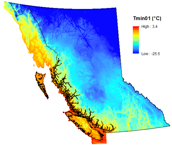
Coverage of ClimateBC raster files indicated by Tmin01
|
|
|
Click to download
Downloaded variables
|
Note: The downloaded files are automatically saved to your Downloads folder on
your computer if you use Chrome, Edge or Firefox, but it requires an additional step with IE (to choose open or save).